 Katie Holmes
What’s up with the 80-degree weather in November? Don’t get me wrong, I love a nice day as much as the next person, but where’s my “cozy sweaters and warm cups of tea” season? It’s no secret that this fall, and this year generally, has been unusually warm. According to North Carolina State University’s Climate Office, October 15th, 2026, was the latest 90-degree day ever recorded in Raleigh. So, why have the summer highs continued into this fall?
There are three factors contributing to the recent record-breaking temperatures. The first, and most well-known, is global climate change. An analysis from Climate Central showed that fall has warmed an average of 2.9 °F in every region of the United States since 1970. There are numerous human behaviors contributing to this general warming trend, but the moral of the story is that fall isn’t likely to get cooler in our lifetimes.
The second contributing factor is an upper-level ridge, or an area of higher-than-normal pressure high in the atmosphere. To understand why this phenomenon causes warm weather, we need to understand a bit about air pressure. Essentially, air pressure describes how much force the air in the atmosphere is putting on the Earth’s surface. There are two ways this force, and therefore air pressure, can change, and both are nicely illustrated by the pressure in your car tires.
When your low tire pressure light starts blinking, what do you do? You add air and the light goes off. Similarly, increasing the amount of air in the atmosphere will increase the air pressure. Now, everyone that keeps their car outside knows that the low tire pressure light will come on as soon as the nights get chilly, so why does heat affect pressure? When the weather gets cold, the molecules in the air filling your tires slow down and, as a result, they hit the tire walls with less force which decreases the air pressure. The atmosphere experiences the same phenomenon and, as a result, cold air is low pressure, and warm air is high pressure.
However, the atmosphere doesn’t have walls like your tires. Warm air is only high pressure when the space it’s in has a constant volume, but the atmosphere’s volume is variably. High up in the atmosphere where air isn’t constrained, warm air is less dense because faster moving molecules spread further apart. Geopotential heights, which describe the relationship between atmospheric height and air pressure, can measure this phenomenon. Higher than normal geopotential heights mean that the atmosphere is reaching a given level of pressure higher up than usual. This is caused by the expansion of warmer and less dense air which, in turn, brings the higher temperatures to the surface that, at least in part, make our October days feel like August.
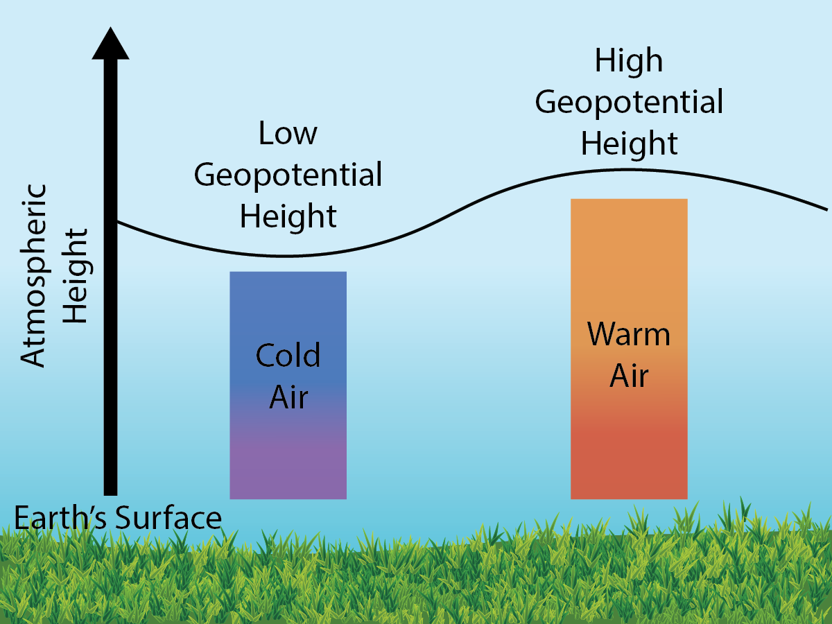
The third reason for the warm temperatures is the much-discussed recording breaking El Niño brewing in the Pacific. What is El Niño? It is a natural and reoccurring weather pattern that causes chaotic changes to global weather. El Niños form when wind carries the warm water around Indonesia east.
So how can a change in the direction of the wind on the other side of the world have such far reaching consequences? When the wind carries warm water eastward it carries tropical storms with it which churn up the atmosphere in unpredictable ways. Some regions get torrential rains, others get persistent drought, but most get warmer. El Niño’s consequences don’t stop at the weather; the warmth shifts sea levels, causing widespread flooding, and bleaches coral reefs, collapsing marine ecosystems. Generally, the effects of El Niño aren’t felt in full until the year after it forms so, as hot as 2026 has been, 2027 will almost certainly be hotter.
Peer Edited by: Sy’keria Garrison
